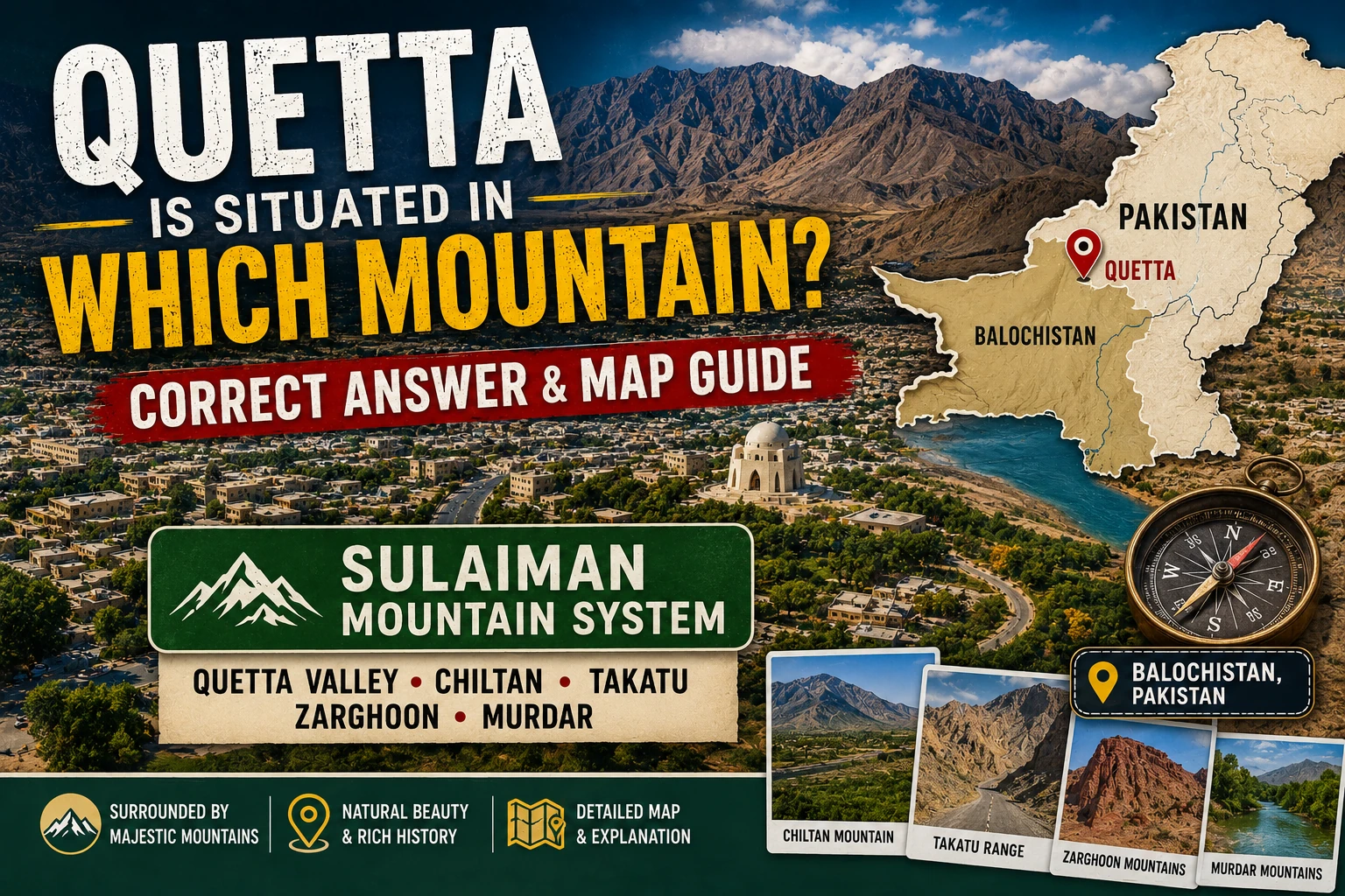
Quetta is not situated on one mountain. The city lies in the elevated Quetta Valley and is surrounded by four prominent mountain ranges or hill systems: Chiltan, Takatu, Zarghoon and Murdar. Therefore, answers that name only the Kirthar Range are misleading. The Government of Balochistan identifies Murdar, Zarghoon, Takatu and Chiltan among the province’s upper-highland ranges, while the Balochistan High Court’s Quetta district history names the same four hills around the city.
People asking “Quetta is situated in which mountain?” are usually looking for a one-line school, general-knowledge or travel answer. Geography is slightly more interesting than the wording of the question suggests: Quetta occupies a basin-like high valley protected by mountains on different sides. No single peak contains the city.
The four names most consistently connected with Quetta are Koh-i-Chiltan, Koh-i-Takatu, Zarghoon Ghar and the Murdar Range. Together they create the dramatic rocky skyline that gives Quetta its natural-fort appearance. This article explains where each lies, why “Kirthar” is not the best direct answer, what the landscape means for weather and travel, and how visitors can plan mountain sightseeing responsibly.
A major rocky range southwest/west of the Quetta Valley.
A prominent mountain system toward the north and northeast.
High ground east of Quetta, linked with Urak and surrounding valleys.
The eastern/southeastern skyline associated with Quetta’s “Sleeping Beauty.”
Where is Quetta geographically located?
Quetta is the capital of Balochistan in western Pakistan. The urban area sits on the floor of a high valley rather than on a mountain summit or steep mountainside. Public references commonly place the city at roughly 1,600–1,700 metres above sea level, although elevation varies across the wider district and depends on the measurement point.
Calling Quetta a “valley city” is the clearest explanation. Its developed area spreads across relatively gentler ground, while surrounding ranges rise sharply around the basin. Openings and passes between the highlands have historically provided routes toward Pishin, Chaman, Mastung, Sibi and other regions.
| Question | Best answer | Common mistake |
|---|---|---|
| Quetta is situated in which mountain? | In the Quetta Valley, surrounded by Chiltan, Takatu, Zarghoon and Murdar. | Naming one peak as if the whole city stands on it. |
| Is Quetta in the Kirthar Range? | The Kirthar system is part of Balochistan’s wider eastern highlands, but it is not the clearest direct description of Quetta city. | Using “Kirthar” as the sole answer for Quetta’s immediate setting. |
| Is Quetta a mountain city? | Yes in the everyday sense: it is a high-elevation valley city encircled by mountains. | Assuming “mountain city” means it is built on one mountain. |
| Which four mountains surround Quetta? | Chiltan, Takatu, Zarghoon and Murdar are the standard four names. | Confusing a local landmark with one of the major surrounding ranges. |
For students: A concise exam-style answer is: “Quetta is situated in the Quetta Valley and is surrounded by the Chiltan, Takatu, Zarghoon and Murdar mountain ranges.” If a particular textbook expects different terminology, follow its syllabus while understanding the more precise geography.
The four mountain ranges surrounding Quetta
The four-range description is not merely a tourism slogan. The official Balochistan portal includes Murdar, Zarghoon, Takatu and Chiltan among upper-highland ranges, and the Quetta district history published by the Balochistan High Court identifies these four hills as a natural bulwark around the city.
Exact boundaries can be described differently by geologists, mapmakers and local speakers. Mountain systems connect, branch and overlap; spelling also varies between English transliterations. “Zarghoon” may appear as Zarghun, “Takatu” as Takatoo, and “Murdar” may appear in forms such as Murdaar or Mehrdar. These spelling differences do not necessarily refer to separate places.
| Range | Position relative to Quetta | Known for | Planning note |
|---|---|---|---|
| Chiltan | Generally west/southwest of the valley | Rocky skyline, Chiltan peak group and Hazarganji-Chiltan landscape | Protected and remote areas require current access and safety information. |
| Takatu | Generally north/northeast | High rugged terrain and important wildlife habitat | Do not attempt an unfamiliar route without local guidance. |
| Zarghoon | Generally east/northeast | High peaks, juniper habitat and the Urak/Wali Tangi side | Road and weather conditions can change with season. |
| Murdar | Generally east/southeast | Distinctive ridgelines and the local Sleeping Beauty profile | Viewing the silhouette is different from safely hiking the mountain. |
Koh-i-Chiltan and the western skyline

Koh-i-Chiltan is one of Quetta’s best-known mountain names. “Koh” means mountain, while Chiltan or Chehel-Tan is commonly connected with the idea of “forty bodies” in regional storytelling. Local folklore about the mountain is culturally important, but legend and measured geography should be presented separately.
Figures quoted for Chiltan depend on whether a source is describing a particular summit or the wider group. One frequently cited elevation for Koh-i-Chiltan is about 3,194 metres. The safer editorial practice is to attach an elevation to the named summit and source, not imply that an entire range has one height.
The wider Chiltan landscape is also associated with wildlife and Hazarganji-Chiltan National Park. Visitors may hear about the Chiltan wild goat or markhor, but wildlife sightings are never guaranteed. Animals should be observed quietly and from a distance; feeding, chasing or approaching them for a photograph damages habitat and can be dangerous.
Koh-i-Takatu north of Quetta
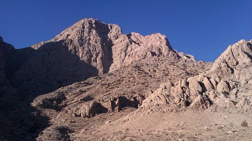
Koh-i-Takatu rises toward the north and northeast of the Quetta area. Different sources publish slightly different figures or distinguish between Takatu and the range’s highest summit. Around 3,400 metres is a useful general sense of the highest terrain, but travellers should use reliable topographic maps for a specific peak or route.
Takatu is ecologically important and associated with Sulaiman markhor habitat. In 2025, Takatu was reported as a newly designated national park spanning areas of Quetta and Pishin. Protected status does not automatically mean every trail has visitor facilities, road access or unrestricted entry. Anyone planning a Takatu mountain tour from Quetta should obtain current guidance from the Balochistan wildlife and local administration authorities.
From the city, a distant ridgeline may look easy to reach. Scale is deceptive in dry mountain country: the approach, gradient, loose rock, lack of shade and mobile-network gaps can turn a casual outing into a serious trip.
Zarghoon Ghar and the eastern highlands
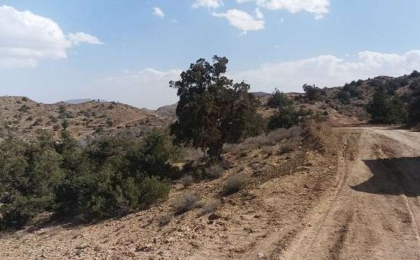
Zarghoon Ghar, also written Zarghun Ghar, lies east of Quetta and forms part of the wider highland setting connected with Urak and Ziarat-side landscapes. Zarghoon is often identified as the highest major summit in Balochistan, with a commonly cited elevation of approximately 3,578 metres. Elevation rankings should be tied to a defined summit and measurement source because lists can differ.
The Zarghoon landscape is important for watersheds, vegetation and juniper habitat. Snow and rain in surrounding heights influence seasonal water flow, while steep slopes and dry conditions make the area sensitive to erosion, fire and human pressure.
People searching for a Quetta mountain picnic package may actually be looking for accessible places on the Urak, Hanna Lake or Wali Tangi side rather than a summit ascent. These are different activities. Ask a guide or transport provider for the exact destination, walking difficulty, road condition, permits, included meals and return time.
Murdar Range and Quetta’s Sleeping Beauty
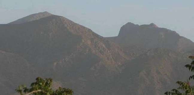
The Murdar Range—also rendered Murdaar, Mehrdar or Koh-e-Murdar in different spellings—forms another major side of Quetta’s mountain enclosure. One of its well-known visual features is a ridgeline that local viewers compare to the profile of a reclining woman, popularly called the Sleeping Beauty of Quetta.
The nickname describes a visual resemblance, not a separate official mountain range. The silhouette also depends on viewing angle and light. A visitor who searches only for “Sleeping Beauty Mountain” may receive inconsistent map results, so a knowledgeable local guide and an agreed observation point are more useful than an isolated pin.
The old Shalkot article stated a precise peak height and province-wide ranking without a strong primary citation. This replacement does not repeat the ranking as settled fact. It is better to give a sourced measurement for a clearly named summit than create false precision.
Is Quetta situated in the Kirthar Range?
Not as the best direct answer. The Kirthar Range is an important mountain system in eastern and southeastern Balochistan and Sindh, and broad descriptions of Balochistan’s highlands may list it alongside the Sulaiman, Pab and other ranges. However, Quetta’s immediate valley setting is normally explained through Chiltan, Takatu, Zarghoon and Murdar.
The earlier version of this post linked to a Google search for “Quetta is situated in Kirthar mountain.” That circular search link has been removed. A search-results page is not evidence, and repeating the phrase can cause Google and readers to treat an oversimplification as fact.
Regional geology is complex. Some nearby mountains may be grouped within wider Sulaiman or Central Brahui systems depending on the reference. That broader classification does not change the practical answer to the question about the four mountains surrounding Quetta.
Jabal-e-Noor-ul-Quran: a landmark, not the city’s enclosing range
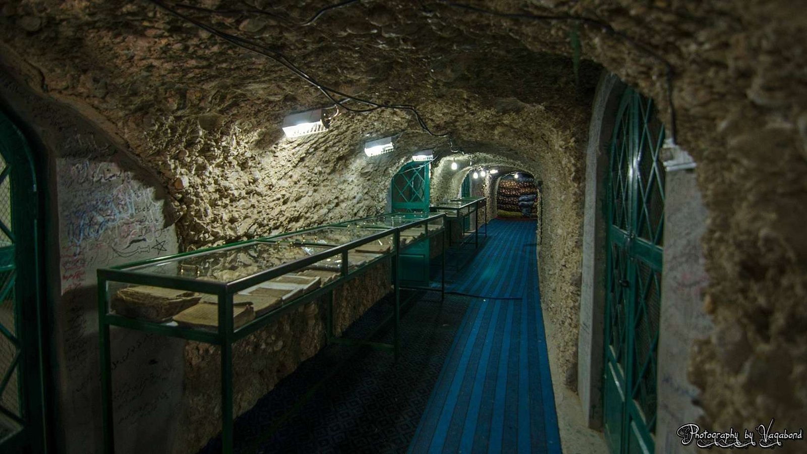
Jabal-e-Noor-ul-Quran near Brewery Road and the Western Bypass is widely known as a place where worn or damaged copies of the Quran have been preserved respectfully. It is meaningful to many visitors, but it should not be listed as the geographic answer to “which mountain surrounds Quetta?”
Visitors should dress respectfully, follow instructions at the site, avoid flash or photography where restricted, and confirm current opening and access arrangements locally. Shalkot has not independently verified claims about the exact age or total number of manuscripts, so those claims are not presented as fixed facts here.
How the mountains shape Quetta’s climate and daily life
Quetta’s elevation and enclosed valley geography contribute to cold winters, large day-to-night temperature differences and occasional snowfall. Summers can still be hot and dry, but nights may feel cooler than lower plains. Mountain barriers also affect airflow, local weather and the movement of dust and pollution.
A basin-like setting can make air-quality problems more noticeable when winds are weak and emissions accumulate. Mountains also shape road access: routes leave the valley through gaps and passes, which can become vulnerable to congestion, construction or severe weather.
Water is another important connection. Snowfall, rain, slopes and catchments influence recharge and runoff, but rapid urban growth and groundwater pressure cannot be solved simply by being surrounded by mountains. Visitors should conserve water and avoid littering streams, picnic areas and dry channels.
Visiting Quetta’s mountain areas: cost, transport and guides
Commercial searches such as Quetta mountain tour price, Quetta hiking guide cost, car rental for Hanna Urak and Quetta sightseeing package do not have one official rate. The final cost depends on destination, vehicle, group size, guide experience, fuel, waiting time, meals, permits and whether technical hiking is involved.
| Service | What a quotation should include | Money-saving check |
|---|---|---|
| Car with driver | Exact destination, pickup, return, vehicle, fuel, toll/parking and waiting | Compare the complete total, not a low base fare. |
| Local sightseeing package | All stops, duration, meals, entry charges and guide role | Do not pay for “mountain tour” without named locations. |
| Hiking guide | Route, difficulty, group size, equipment, emergency plan and permits | A qualified, route-aware guide is more valuable than the lowest quote. |
| Hotel in Quetta | Taxes, parking, heating/cooling, cancellation and distance from pickup | Check the final booking total and recent verified reviews. |
| Group transport | Legal seating capacity, luggage, driver hours and return arrangement | Divide cost only after confirming safe passenger capacity. |
Ask for prices in writing and do not assume that an Instagram photograph proves a guide’s qualifications. For protected areas, confirm whether permission is needed. A responsible operator should be willing to explain the route, turnaround time and what happens if weather deteriorates.
Basic mountain-safety checklist
- Check the current weather and road situation on the day of travel.
- Tell a trusted person your route and expected return time.
- Carry sufficient water, food, sun protection and season-appropriate layers.
- Use footwear suitable for loose rock rather than ordinary smooth-soled shoes.
- Do not hike alone on an unfamiliar or unmarked route.
- Keep distance from wildlife and livestock-guarding dogs.
- Avoid cliffs, unstable slopes and flood channels.
- Turn back before darkness or severe weather makes retreat difficult.
- Take rubbish home and do not damage plants, rocks or religious sites.
Safety note: This page is a geography and planning guide, not a live route assessment. Mobile coverage, weather, access and security conditions can change. Obtain local official advice before visiting remote areas.
Frequently asked questions
Quetta is situated in which mountain?
Quetta is situated in the Quetta Valley, not on one mountain. Chiltan, Takatu, Zarghoon and Murdar surround the city.
Which four mountains surround Quetta?
The four standard names are Chiltan, Takatu, Zarghoon and Murdar. English spellings can vary.
Is Quetta situated in the Kirthar Mountains?
Kirthar is part of Balochistan’s wider mountain geography, but it is not the most accurate direct answer for Quetta’s immediate valley. Use the four surrounding ranges.
Is Quetta a valley or a mountain?
Quetta is a city located in a high valley enclosed by mountains. It is often called a mountain city in everyday language.
What is the highest mountain near Quetta?
Zarghoon Ghar is widely cited as the highest major summit in Balochistan at about 3,578 metres. Rankings and measurements should be checked against the named summit and source.
Where is the Sleeping Beauty of Quetta?
The nickname refers to a human-like ridgeline profile associated locally with the Murdar mountain landscape. The best viewing point depends on angle and local access.
Is Jabal-e-Noor one of the four main ranges?
No. Jabal-e-Noor-ul-Quran is a religious and cultural landmark near Quetta, not one of the four major ranges enclosing the valley.
Can tourists hike Chiltan or Takatu?
Some mountain outings may be possible, but access, protected-area rules, route difficulty, weather and security can change. Seek current official and experienced local guidance.
How much does a Quetta mountain tour cost?
There is no standard price. Request an itemized quote based on the exact destination, vehicle, group, guide, duration, permits, meals and return plan.
What is the best one-line answer for a school question?
“Quetta lies in the Quetta Valley and is surrounded by the Chiltan, Takatu, Zarghoon and Murdar mountain ranges.”
Summary
The most accurate response is not a single mountain name. Quetta lies on the floor of a high valley whose immediate skyline is formed by Chiltan, Takatu, Zarghoon and Murdar. These ranges influence the city’s appearance, climate, travel routes, ecology and identity.
Replacing the old “Kirthar mountain” wording matters for both readers and search quality. A direct factual answer at the top satisfies students and voice-search users, while the fuller explanation serves travellers, local residents and anyone interested in Balochistan’s geography.
2 thoughts on “Quetta Is Situated in Which Mountain? Correct Answer & Map Guide”